Grand Island Wet Meadow Restoration Project
Right-click here
to download a copy of this Word file.
Introduction
For the past three years the University of Nebraska at Kearney Biology Department has been working in cooperation with the Central Platte Natural Resource District, Central Nebraska Public Power and Irrigation District, Nebraska Game and Parks, and the Nebraska Public Power District on a wet meadow restoration project. The central theme of this project has been to examine the alternative methods to maintaining or enhancing wet meadow habitat in and along the Platte River in Central Nebraska. Wet meadows are defined as a complex of grassland and wetland areas that occur with in close proximity to a river channel. These areas may have a hydrologic connection to river flows or groundwater. Wet meadows are generally confined to the river flood plain, and most are located with in one or two miles of the river channel. They generally have pooled or ponded standing water during a portion of the year that result from the hydrological interconnection that they share with the river through a common water table and on occasion, by surface water overflow. Wet meadows once accounted for a majority of the land in and along the Platte River Valley, but due to expanding agricultural cultivation these meadows are rapidly disappearing. It has been noted that these meadows are an important foraging area for migratory birds due to the diverse invertebrate fauna that inhabit these meadows. These soil and foliage invertebrates provide a high-energy food source for migratory birds like cranes and waterfowl. It has also been hypothesized that these meadows are very efficient at removing agriculturally derived nitrogen pollutants from runoff. This process helps to reduce non-point pollution from contaminating the municipal water supplies. The ecological importance of these lands supports the ideology that wet meadows need to be studied, preserved, and restored to preserve a healthy ecosystem.
Where is UNK Actively Involved in Research
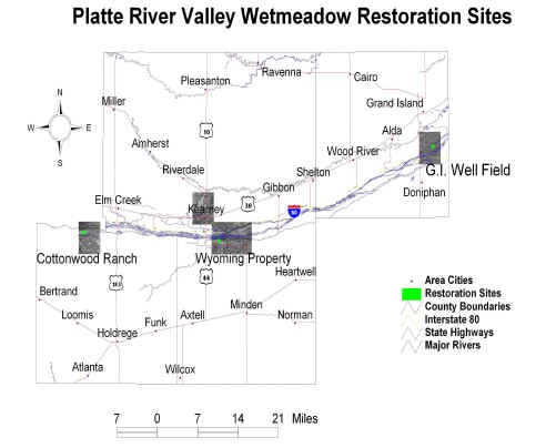
There are three study sites that are currently being
examined in this monitoring period. The Grand Island Well Field is located in
Hall County and is just south of the city of Grand Island. The Wyoming Property
is located in Kearney County and is just south of Kearney. The Cottonwood Ranch
site is located in Phelps County and is just south of the city of Elm Creek.
How is GIS Being Used
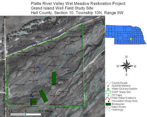
The use of GIS technology has helped to ensure accurate data acquisition during this study. By utilizing differentially corrected global positioning system (GPS) points study quadrants have been mapped allowing researchers to return to the same study site and track changes that occur over the growing season as well as the yearly changes.
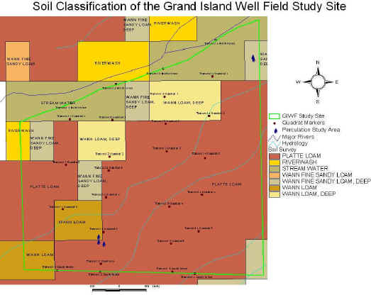
As this data concerning the percolation, surface flow and soil type becomes better understood new and more efficient practices can be utilized for management of wet meadows. Soil classification and hydrological map layers have been produced that allow researchers to make more educated hypothesis concerning the observable trends noted in wet meadow physiology. Percolation or the rate that water is able to move through the soil has been monitored for several years at these sites. By examining the percolation rates of different saturated soil types calculations can be made and the most efficient amount of water can be plumped or delivered to the restored meadow allowing it to remain flooded despite the water loss into the soil. By correlating percolation data with soil types modeling can be completed to suggest the amount of water that needs to be pumped or diverted over the restored/enhanced area. By releasing this quantity of water the meadows will be exposed to the flooding cycles that were historically observed in wet meadows during the spring periods when they were flooded. This map illustrates the soil types located at the Grand Island Well Field study site and the location of the percolation sampling sites.