Fort Robinson Image Page 2
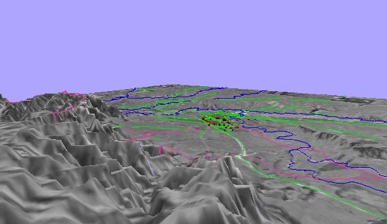
This first image is looking right up the canyons. This view is close to due north. The brown rectangles are buildings (sort of) that help locate features for you Giant's Tomb is just to the right (east) of the view. Trails through the park are in pink, roads in green, water in blue. The grey image is an aerial photo draped over the 3-D surface (as in Page 1).
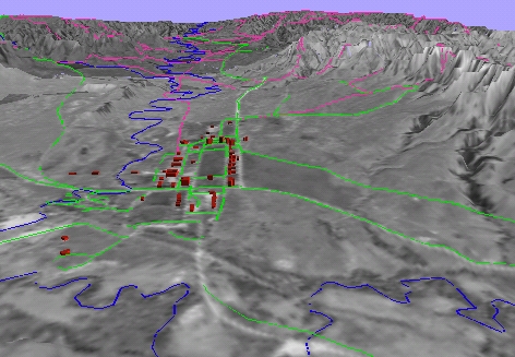
This image is 'taken' (would you say virtually viewed?) from a higher altitude and from farther west. This view shows the quality of the aerial photograph much better. The fields near Crawford, NE can be seen on the east (right) side of the image. Giant's Tomb and Lover's Leap are now visible as features of Saddle Rock to the east of the Fort Robinson building compound.
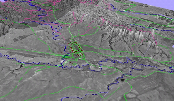
This image is viewed from the northeast back towards the buildings of Fort Robinson. Notice the trails follow the contours of the draped surface. Any view is possible with this virtual landscape (even from underneath!).